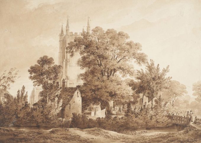
Jacob’s Island formed by a loop in the River Neckinger c1860. Formerly known as Folly Ditch. Watercolour J L Stewart 1829-1911 @Museum of London
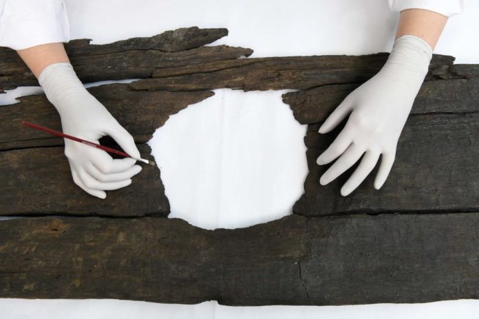
Here is a link to a very interesting article on London’s Lost and Forgotten Rivers with details of some interesting finds recovered from the Thames including, my favourites , a 12th century triple toilet seat, a Roman bracket cast in the shape of a thumb, Bronze Age and medieval swords and a dog collar finally engraved with ‘Gray Hound’

Dog Collar inscribed Gray Hound

12th century triple toilet seat
As The London Museum curator Kate Sumnall succinctly puts it “They are still there, and they’re flowing. Some of them you can still see, others are beneath our feet, but the little clues around London survive. Once you start paying attention to them the rivers jump out at you and you realise that you know far more about them than you think’.

The River Fleet shown on the ‘Copperplate’ map of London c 1553.
The Fleet rose on Hampstead Heath, flowed beneath Fleet Bridge , now the site of Ludgate Circus, and Holborn Bridge past Bridewell Palace, built by Henry VIII and into the Thames.

Bridewell Palace and Blackfriars Monastery at the entrance to the River Fleet. From a model by John B Thorp
Archaeologists still argue about the exact route of the River Tyburn but it is agreed that it flowed from the Hampstead Hills, across Regents Park to form an eyot which was called Thorney Island whereupon stood Westminster Abbey and the old Palace of Westminster
Westminster Abbey and the Palace of Westminster once stood on the eyot formed from the River Tyburn known as Thorney Island..

The eyot known as Thorney Island
The River Walbrook is short, but as it was the only watercourse to flow through the City it was both an important source of water as well as a conduit to remove sewerage. It may have come by its name because it flowed through London Wall. The source of the Walbrook is still argued over but one plausible suggestion is that it begun its life near St Leonards Church, Shoreditch, meandering down and under what is now The Bank of England and entering the Thames close to where Cannon Street Station now stands. As time passed it was vaulted over, paved and made level to the streets and lanes and thus built over – alas.
Map of London c.1300 with the River Walbrook shown

The River Walbrook, as it now flows beneath the Bank of England. Photograph taken by Steve Duncan 2007
The River Wandle, one of the longest of London’s rivers, passed through the boroughs of Croydon, Sutton, Merton, Wandsworth and Lambeth to join the Thames on the tideway. It flowed through the grounds of Croydon Old Palace, sometime residence of Margaret Beaufort, the mother of Henry VII and where the young widowed Katherine of Aragon lived for a time, when that place was but a quiet village and at one time renowned for its fish, particularly trout. However eventually becoming an open sewer leading to outbreaks of cholera and typhoid , it too was culverted over in the 19th century.

Croydon Church with the River Wandle flowing past . Water colour by James Biourne. Courtesy to both Museum of London and museumcrush.org
The Neckinger is believed to have risen close to where the Imperial War Museum now stands, crossed the New Kent Road and flowed either past or through Bermondsey Abbey, where disgraced Queens were sent to languish and die. A loop in the Neckinger became known as Jacob’s Island. The Neckinger met the Thames via St Saviours Dock which was created by the Cluniac monks of the Abbey in the 13th century who named it after their patron saint and built a watermill there.
Are there any South Londoners out there? You have your very own river – the Effra. Now culverted it once flowed, roughly, from the hills of Norwood, once part of the Great North Wood, Upper Norwood, Dulwich, Brixton and Kennington until it met the River Thames at Vauxhall.
I have only touched upon the copious amount of information that is readily available on London’s lost rivers. Its amazing to think that these historic rivers survive beneath the feet of thousands of Londoners as, totally unaware, they go about their business…
If you enjoyed this post you might like :
SIR PAUL PINDAR c.1565-1650. AND HIS HOUSE IN BISHOPSGATE
RICHARD WHITTINGTON c.1350-1423. MERCER, MAYOR AND A MOST BENEVOLENT CITIZEN OF LONDON
L’Erber – London Home to Warwick the Kingmaker and George Duke of Clarence
THOMAS CROMWELL’S HOUSE IN AUSTIN FRIARS
THE ORANGE AND LEMON CHURCHES OF OLD LONDON
THE ANCIENT GATES OF OLD LONDON
GREENWICH PALACE – HUMPHREY DUKE OF GLOUCESTER’S PALACE OF PLEAZANCE
CLATTERN BRIDGE -A MEDIEVAL BRIDGE – KINGSTON UPON THAMES
CROSSRAIL – A PORTAL INTO MEDIEVAL LONDON
River wondle played there as a young boy growing up nice memories.
LikeLiked by 1 person